Eastgate – Lawrenceburg via Riverfront
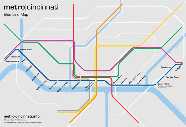
The Blue Line is an east-west line running from the eastern suburb of Eastgate to the town of Lawrenceburg in southeast Indiana. This line shares terminals at either end with the Purple Line, but travels further to the south. With the exception of a few miles at the eastern end of the line along Interstate 275, the Blue Line travels almost entirely along existing railroad rights-of-way that closely follow the north bank of the Ohio River. The line is almost entirely above-grade except for a 1.5-mile segment through downtown Cincinnati.
The Blue Line is approximately 44.0 miles long, and serves 18 stations.
Route Map
| Eastgate | ||||||
| State Route 32 at Eastgate Boulevard, Cincinnati, Ohio
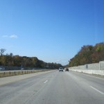
This station serves as the eastern terminal for the Blue Line and Purple Line, and consists of two island platforms and four tracks in the median of Route 32 between I-275 and Eastgate Boulevard. (Route 32 would be shifted to accommodate the width of the station.) the Fare control is located on a mezzanine level above the platforms, with access to a large Park & Ride facility and the nearby Eastgate Mall. A rail storage yard and maintenance facility would be located nearby. Upon leaving the station, Purple Line trains continue west in the median of Route 32, while Blue Line trains branch off to the south and travel along the I-275 corridor. |
||||||
| Beechmont Avenue |
||||||
| Interstate 275 at Beechmont Avenue, Union Township, Ohio
This station consists of an island platform with two tracks in the median of Interstate 275 as it crosses Beechmont Avenue. Fare control is below the station in a station house on Beechmont Avenue. A Park & Ride garage is connected to the station.
|
||||||
| Five Mile Road |
||||||
| Interstate 275 at Five Mile Road, Anderson Township, Ohio
This station consists of an island platform with two tracks in the median of Interstate 275 as it crosses Beechmont Avenue. Fare control is below the station in a station house on Five Mile Road. A Park & Ride garage is connected to the station. The Blue Line continues in the median of I-275 to the Kellogg Road interchange, at which point it leaves the interstate and follows Kellogg Road south on an elevated viaduct for a short distance before turning west and following Kellogg Avenue (US 52). |
||||||
| Coney Island | ||||||
| Coney Island Amusement Park Riverbend Music Center River Downs Race Track Kellogg Avenue at Sutton Road, Cincinnati, Ohio The Coney Island station is on an elevated viaduct alongside Kellogg Avenue. The station consists of two tracks with side platforms, with fare control located in a station house at ground level. The entrance to the station is a short walk away from the main entrance of the Coney Island Amusement Park. The Riverbend Music Center — an outdoor ampitheater that serves as the summer home of the Cincinnati Symphony Orchestra an as a venue for other musical performances — and the River Downs horserace track are near the station. A Park & Ride facility is also provided here.
The Blue Line continues west along Kellogg Avenue, crossing I-275 and the Little Miami River. West of the Little Miami River crossing, the Blue Line travels alongside Airport Road, which forms the southern boundary of Lunken Aiport. Approaching Wilmer Avenue, the tracks descend into a shallow open cut. |
||||||
| Lunken Field |
||||||
| Cincinnati Municipal Lunken Airport Airport Road at Wilmer Avenue, Cincinnati, Ohio This station consists of an island platform in an open cut, with fare control located in a station house on Wilmer Avenue, a short walk from the airport’s main terminal. A Park & Ride facility is also provided. The station provides convenient access to Lunken Airport, which primarily serves general aviation and corporate jets. (The Gold Line and Silver Line provide transit service to Cincinnati / Northern Kentucky International Airport located in Boone County, which is Cininnati’s primary commercial airport.) West of the Lunken Airport station, the Blue Line ascends onto an elevated viaduct and joins the Oasis Line, an abandoned freight railroad line that parallels Eastern Avenue on a grade-separated embankment. |
||||||
| Columbia-Tusculum | ||||||
| Eastern Avenue at Delta Avenue, Cincinnati, Ohio
The Columbia-Tusculum station is on the Oasis Line embankment, with side platforms and fare control located in a station house at street level. A streetcar line from Uptown through Hyde Park and Mount Lookout terminates at this station.
|
||||||
| East End | ||||||
| 2452 Eastern Avenue, Cincinnati, Ohio
This station consists of an island platform and two tracks. Fare control is in a concourse below the railroad embankment that opens to Eastern Avenue, and provides access to elevators serving a Park & Ride garage above the station. The top floor of the garage opens to the intersection of Columbia Parkway and William Howard Taft Road, making the station easily accessible to the western Hyde Park and East Walnut Hills neighborhoods.
West of the station, the Blue Line follows the existing railroad to the vicinity of the Montgomery Inn Boathouse, at which point it descends into a shallow cut-and-cover subway tunnel traveling under Pete Rose Way. |
||||||
| Sawyer Point | ||||||
| Newport Southbank Bridge at Pete Rose Way, Cincinnati, Ohio
This station consists of side platforms, with a mezzanine providing access to a station house at street level, which contains fare control. The station house also provides access to the Red Line platforms above. Traveling west under Pete Rose Way, the Blue Line enters the Riverfront Transit Center. |
||||||
| Riverfront | ||||||
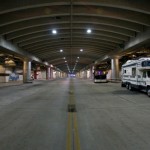
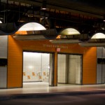
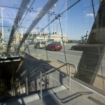
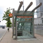
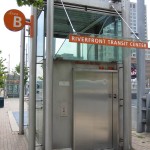
| Great American Ballpark Paul Brown Stadium National Underground Railroad Freedom Center Central Riverfront Park West 2nd Street at Vine Street, Cincinnati, Ohio The Riverfront Transit Center is a facility completed in 2003 following the reconstruction of nearby Fort Washington Way. Designed to accommodate future rail use, the Riverfront Transit Center is a large underground space running below Second Street between Main Street and Elm Street in downtown Cincinnati. The Blue Line station consists of two tracks running through the center of the Riverfront Transit Center, with wide side platforms to accommodate crowds from nearby sports and entertainment venues, as well as provide access to the deep-bore Orange Line and Gold Line platforms below, running perpendicular to the Blue Line under Vine Street. Fare control is on a mezzanine level above the platforms, with access to street level provided by existing kiosks. West of the Riverfront station, the Blue Line travels in a subway under Pete Rose Way for a short distance, before emerging above-ground onto an elevated viaduct alongside existing railroad tracks west of the Brent Spence Bridge. The Silver Line tracks run alongside the Blue Line as both lines approach the Queensgate station. |
||||||
| Queensgate | ||||||
| Dalton Street and Linn Street, Cincinnati, Ohio
The Queensgate neighborhood of Cincinnati is immediately to the west of downtown, and consists primarily of light industrial and warehouse uses. Queensgate is currently separated from downtown by the sprawling I-71/75 expressway interchange and approach ramps to the Brent Spence Bridge. With plans underway to replace the bridge and highway interchange, however, this neighborhood could potentially be reconnected to downtown and see large-scale future development. This station consists of two elevated island platforms serving the Silver Line and Blue Line, and one subway island platform serving Red Line and Green Line. The above-ground and below-ground portions of the station share a common station house at street level. Departing the Queensgate station, Silver Line trains turn north toward Union Terminal, and Blue Line tracks continue west on an elevated viaduct, following the existing railroad tracks alongside River Road. |
||||||
| Lower Price Hill | ||||||
| River Road at State Avenue, Cincinnati, Ohio
This station consists of two side platforms on an elevated viaduct, with fare control located in a station house at street level. |
||||||
| Sedamsville | ||||||
| River Road at Southside Avenue, Cincinnati, Ohio
The Sedamsville station consists of two side platforms. Fare control is located in a station house above the station, which opens to River Road. A Park & Ride facility is provided. |
||||||
| Anderson Ferry | ||||||
| River Road at Anderson Ferry Road, Cincinnati, Ohio
This station consists of two side platforms on an elevated viaduct, with fare control located in a station house at street level. The station includes a Park & Ride facility, and provides access to the historic Anderson Ferry across the Ohio River to Kentucky. |
||||||
| Sayler Park | ||||||
| River Road at Monitor Avenue, Cincinnati, Ohio
This station consists of two side platforms on an elevated viaduct, with fare control located in a station house at ground level. A Park & Ride facility is also provided. In the vicinity of Thornton Avenue, the Blue Line diverges from the freight railroad right-of-way and travels on an elevated viaduct alongside River Road as the highway passes to the north of a large manufacturing facility. |
||||||
| Addyston | ||||||
| Three Rivers Parkway at Germany Street, Addyston, Ohio
This station consists of two side platforms on an elevated viaduct, with fare control located in a station house at ground level. A Park & Ride facility is also provided. West of the Addyston station, the Blue Line rejoins the existing freight railroad right-of-way. Approaching the village of Cleves, the line diverges from the main railroad, following a spur line alongside US 50. |
||||||
| Cleves | ||||||
| Three Rivers Parkway at West State Road, Cleves, Ohio
This station consists of two side platforms on an elevated viaduct, with fare control located in a station house at ground level. A Park & Ride facility is also provided. Leaving the station, the Blue Line follows the existing railroad right-of-way across the Great Miami River, running roughly parallel to US 50. After passing under Interstate 275, the Purple Line joins the Blue Line and travels on the same tracks. |
||||||
| Greendale | ||||||
| East Eads Parkway and Belleview Drive, Lawrenceburg, Indiana
This is an above-ground station on an embankment, with an island platform. Fare control is at ground level, facing Eads Parkway. A Park & Ride facility is provided at this station. At this point the rapid transit alignment departs the freight railroad right-of-way, and continues south along the east side of Eads Parkway (US 50) on an elevated embankment. This embankment forms part of the levee between Eads Parkway and the Great Miami River. As trains approach the Old Town area of Lawrenceburg, they depart the levee structure and continue alongside Eads Parkway on an elevated viaduct, before transitioning into a shallow short cut-and-cover subway tunnel running under Eads Parkway for the final half-mile of the route. A rail storage yard and maintenance facility is nearby. |
||||||
| Lawrenceburg | ||||||
| Eads Parkway at Main Street, Lawrenceburg, Indiana
This station consists of two island platforms and four tracks. One platform serves Purple Line trains; the other serves Blue Line trains. Fare control is at the platform level, with access to the street via sidewalk kiosks. |
Notes / Image Credits
- Ronny Salerno, “Cincinnati’s Other Abandoned Subway,” Queen City Discovery, http://queencitydiscovery.blogspot.com/2009/05/cincinnatis-other-abandoned-subway.html [accessed 9 August 2009].
- Ronny Salerno, “Cincinnati’s Other Abandoned Subway.”
- Ronny Salerno, “Cincinnati’s Other Abandoned Subway.”

