Eastgate – Lawrenceburg via Central Parkway
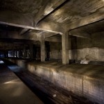
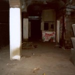
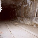
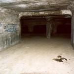
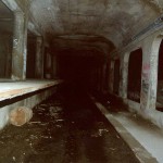
The Purple Line is an east-west line running from the eastern suburb of Eastgate to the western suburb of Lawrenceburg, Indiana via downtown Cincinnati. The Blue Line shares the same terminals at either end, but takes a more southerly route along the Ohio River for its entire length; the Purple Line generally runs further north. This line reactivates the abandoned 1920’s-era subway tunnels and stations below Central Parkway, and shares much of its route with the Green Line and Red Line.
The Purple Line is approximately 44.1 miles long, and serves 23 stations.
Route Map
| Eastgate | ||||||||
| State Route 32 at Eastgate Boulevard, Cincinnati, Ohio
This station serves as the eastern terminal for the Blue Line and Purple Line, and consists of two island platforms and four tracks in the median of Route 32 between I-275 and Eastgate Boulevard. (Route 32 would be shifted to accommodate the width of the station.) the Fare control is located on a mezzanine level above the platforms, with access to a large Park & Ride facility and the nearby Eastgate Mall. A rail storage yard and maintenance facility would be located nearby. Upon leaving the station, Blue Line trains branch off to the south and travel along the I-275 corridor, while Purple Line trains continue west in the median of Route 32. West of the I-275 interchange, trains ascend onto an elevated viaduct and cross to the north side of the highway. |
||||||||
| Mount Carmel Road | ||||||||
| Batavia Pike at Mount Carmel Road, Cincinnati, Ohio
This is an elevated station with side platforms. Fare control is in a station house at ground level. Trains continue traveling west on an elevated viaduct alongside the highway, until approximately Hickorycreek Drive. At this location, the viaduct diverges from the highway through a wooded area, before joining the existing Norfolk Southern right-of-way that runs approximately a quarter-mile north of Route 32. Trains continue west alongside the Norfolk Southern tracks, running at grade. Trains ascend onto a viaduct prior to crossing Round Bottom Road. |
||||||||
| Newtown | ||||||||
| 3624 Church Street, Newtown, Ohio
This is an elevated station with side platforms. Fare control is in a station house at ground level. Leaving the Newtown station, trains continue along the Norfolk Southern right-of-way, descending to ground level after crossing Debott Road. Trains continue at grade, turning north and crossing the Little Miami River just south of Mariemont. Here, trains turn west and continue alongside the Little Miami before joining the Green Line tracks in the vincinity of Columbia Parkway and Red Bank Road. |
||||||||
| Fairfax | ||||||||
| Columbia Parkway and Red Bank Road, Cincinnati, Ohio
This is an elevated station with side platforms. Fare control is in a station house at ground level. Traveling west, trains cross a long viaduct before heading through Ault Park on the currently-abandoned Wasson rail line. Trains travel at grade until reaching Paxton Road, at which point they ascend onto an elevated viaduct running alongside Wasson Road. |
||||||||
| Hyde Park | ||||||||
| Wasson Road at Edwards Road, Cincinnati, Ohio
This is an elevated station with side platforms. Fare control is in a station house at ground level. Leaving the station westbound, trains descend to grade level and continue along the Wasson line, crossing Interstate 71. West of I-71, the Orange Line joins the Purple and Green Line right-of-way but remains on separate tracks. Purple, Green, and Orange Line trains descend into an open cut before entering the next station. |
||||||||
| Evanston | ||||||||
| 3722 Montgomery Road, Cincinnati, Ohio
This station serves as a transit hub and transfer point between the Purple Line, Green Line, and Gold Line. The station consists of two island platforms with four tracks, located in an open cut north of Dana Avenue. Fare control is on a mezzanine level at grade. West of this station, Purple and Green Line trains turn south, and descend into a subway at Victory Parkway, and continue southwest under Gilbert Avenue. Gold Line trains continue west, descending into a subway under Dana Avenue. |
||||||||
| Walnut Hills | ||||||||
| Gilbert Avenue at East McMillan Street, Cincinnati, Ohio
The Walnut Hills station is an underground station with side platforms, and fare control located on mezzanines at either end. The north mezzanine provides access to and from William Howard Taft Drive; the south mezzanine opens to East McMillan Street. Street access is via sidewalk kiosks and elevators. |
||||||||
| Eden Park | ||||||||
| Gilbert Avenue at Eden Park Drive, Cincinnati, Ohio
This is an underground station with side platforms. Fare control is on a mezzanine above the platforms. Street access is via sidewalk kiosks and elevators. Southwest of this station, Purple Line trains pass under Interstate 71 and travel in a subway under Reading Road, while Green Line trains continue south under Mount Adams. |
||||||||
| Pendleton | ||||||||
| Reading Road at Pendleton Street, Cincinnati, Ohio
This is an underground station with side platforms. Fare control is on a mezzanine above the platforms. Street access is via sidewalk kiosks and elevators.
Traveling west, Reading Road becomes Central Parkway. In the vicinity of Walnut Street, the subway joins the original 1925 subway tunnels. |
||||||||
| Gateway | ||||||||
| Central Parkway at Vine Street, Cincinnati, Ohio
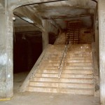
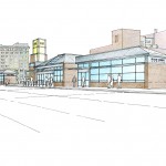
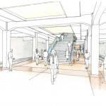
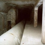
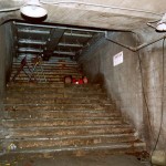
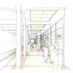
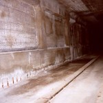
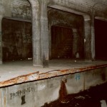
This is the first of four existing subway stations built in the early 1920’s as part of Cincinnati’s efforts to built a comprehensive subway system. Originally designated as the Race Street station, this station consists of a large island platform with stairs, escalators, and elevator to a mezzanine level below. The original configuration of this station included a third center track for interurban trains; this trackway is filled in to become part of the platform. Crossing perpendicular to this station under Vine Street is the Orange and Gold Line subway. Transfer between the Purple Line, Orange Line, and Gold Line is via a mezzanine level below the shallow Central Parkway subway and the deeper Vine Street subway. This mezzanine level also contains the fare control, and provides access to the street level. The original Race Street entrance to the station will serve as a secondary entrance/exit. |
||||||||
| Liberty Street | ||||||||
| Central Parkway at West Liberty Street, Cincinnati, Ohio
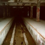
This station consists of side platforms in a shallow cut-and-cover tunnel, with fare control located at platform level for each direction. |
||||||||
| Linn Street | ||||||||
| Central Parkway at Linn Street, Cincinnati, Ohio
The Linn Street station consists of side platforms in a shallow cut-and-cover tunnel, with fare control located at platform level for each direction.
|
||||||||
| Brighton |
||||||||
| Central Parkway and Western Hills Viaduct, Cincinnati, Ohio
This is a shallow cut-and-cover station, with side platforms. Fare control would be located on a newly-built station house at ground level. Extensive renovation of the existing station would be required to bring it up to modern standards. North of this station, trains emerge onto a viaduct that runs alongside Interstate 75 for several blocks before re-entering existing tunnels in the vicinity of Hopple Street. The existing tunnels currently come to a dead-end in this vicinity; new tunnels are proposed to begin where the original tunnels end. |
||||||||
| Camp Washington | ||||||||
| Central Parkway at Hopple Street, Cincinnati, Ohio
This is an underground station with side platforms. Fare control is located on a mezzanine level above the platforms. |
||||||||
| Cincinnati State | ||||||||
| Central Parkway at College Drive, Cincinnati, Ohio
This is an underground station with side platforms. Fare control is located on a mezzanine level above the platforms. Upon leaving this station, trains pass under Interstate 75 and Mill Creek. |
||||||||
| Northside | ||||||||
| Hamilton Avenue at Blue Rock Street, Cincinnati, Ohio
This is an underground station with its main entrance on the southwest corner of Hamilton Avenue and Blue Rock Street, the former Vandalia Avenue right-of-way now used as a parking lot. Tracks are on two levels, with northbound Red Line and westbound Purple Line trains on the upper level, and southbound Red Line and eastbound Purple Line trains on the lower level. Fare control is on the upper track level. The dual-level track configuration allows the Purple Line and Red Line routes to split north of the station while preventing diverging trains from crossing each others’ paths.
Leaving Northside, Purple Line trains diverge from the Red Line and turn west, emerging at ground level in the median of Interstate 74. |
||||||||
| Montana Avenue | ||||||||
| Interstate 74 at Montana Avenue, Cincinnati, Ohio
This station consists of an island platform in the median of Interstate 74, with fare control located in a station house on Montana Avenue. A Park & Ride facility is also provided. |
||||||||
| Monfort Heights | ||||||||
| Interstate 74 at North Bend Road, Monfort Heights, Ohio
This station consists of an island platform in the median of Interstate 74, with fare control located in a station house on North Bend Road. A Park & Ride facility is also provided. |
||||||||
| Dent | ||||||||
| Interstate 74 at Harrison Avenue, Dent, Ohio
This station consists of an island platform in the median of Interstate 74, with fare control located in a station house on Harrison Avenue. A Park & Ride facility is also provided. |
||||||||
| Miamitown | ||||||||
| Interstate 74 at Hamilton Cleves Road, Miamitown, Ohio
This station consists of an island platform in the median of Interstate 74, with fare control located in a station house on Hamilton Cleves Road. A Park & Ride facility is also provided. |
||||||||
| Whitewater | ||||||||
| 4744 Suspension Bridge Road, Whitewater, Ohio
This station consists of an island platform in the median of Interstate 275, which runs on an elevated embankment at this point. Fare control located in a station house at ground level, connected to the platform via a concourse passing below the eastbound lanes of the expressway. A Park & Ride facility is also provided, with an entrance on Suspension Bridge Road. This road runs parallel to the expressway and provides access to neighboring communities in this semi-rural area. Access to the station from I-275 is via the nearby Kilby Road interchange. Leaving the station, Purple Line trains cross the Whitewater River and continues southwest in the median of Interstate 275 for approximately four miles, before departing the expressway right-of-way at US 50. The Purple Line joins the existing freight railroad right-of-way that parallels US 50, which also carries the Blue Line. Purple Line and Blue Line trains continue at grade along the railroad right-of-way for approximately two miles to the next station. |
||||||||
| Greendale | ||||||||
| East Eads Parkway and Belleview Drive, Lawrenceburg, Indiana
This is an above-ground station on an embankment, with an island platform. Fare control is at ground level, facing Eads Parkway. A Park & Ride facility is provided at this station. At this point the rapid transit alignment departs the freight railroad right-of-way, and continues south along the east side of Eads Parkway (US 50) on an elevated embankment. This embankment forms part of the levee between Eads Parkway and the Great Miami River. As trains approach the Old Town area of Lawrenceburg, they depart the levee structure and continue alongside Eads Parkway on an elevated viaduct, before transitioning into a shallow short cut-and-cover subway tunnel running under Eads Parkway for the final half-mile of the route. A rail storage yard and maintenance facility is nearby. |
||||||||
| Lawrenceburg | ||||||||
| Eads Parkway at Main Street, Lawrenceburg, Indiana
This station consists of two island platforms and four tracks. One platform serves Purple Line trains; the other serves Blue Line trains. Fare control is at the platform level, with access to the street via sidewalk kiosks. |
Notes / Image Credits
- Jake Mecklenborg, “Abandoned Subway: Race Street Station Photos”, Cincinnati-Transit.net, http://www.cincinnati-transit.net/subway-racetour1.html [accessed 25 July 2009].
- Jake Mecklenborg, “Abandoned Subway: Race Street Station Photos”, Cincinnati-Transit.net, http://www.cincinnati-transit.net/subway-racetour4.html [accessed 25 July 2009].
- Jake Mecklenborg, “Abandoned Subway: Race Street Station Photos”, Cincinnati-Transit.net, http://www.cincinnati-transit.net/subway-racetour4.html [accessed 25 July 2009].
- Ronny Salerno, “The Cincinnati Subway”, Queen City Discovery, http://queencitydiscovery.blogspot.com/2009/03/cincinnati-subway.html [accessed 3 August 2009].
- City of Cincinnati, “Cincinnati Subway Conversion Study” (PowerPoint presentation), prepared by URS Corporation, September 2008, Slide 25.
- City of Cincinnati, “Cincinnati Subway Conversion Study” (PowerPoint presentation), prepared by URS Corporation, September 2008, Slide 25.
- Jake Mecklenborg, “Abandoned Subway: Liberty Street Station Photos”, Cincinnati-Transit.net, http://www.cincinnati-transit.net/subway-libertytour1.html [accessed 25 July 2009].
- Jake Mecklenborg, “Abandoned Subway: Liberty Street Station Photos”, Cincinnati-Transit.net, http://www.cincinnati-transit.net/subway-libertytour6.html [accessed 25 July 2009].
- Jake Mecklenborg, “Abandoned Subway: Liberty Street Station Photos”, Cincinnati-Transit.net, http://www.cincinnati-transit.net/subway-libertytour5.html [accessed 25 July 2009].
- City of Cincinnati, “Cincinnati Subway Conversion Study” (PowerPoint presentation), prepared by URS Corporation, September 2008, Slide 27.
- Jake Mecklenborg, “Abandoned Subway: Linn Street Station Photos”, Cincinnati-Transit.net, http://www.cincinnati-transit.net/subway-linntour1.html [accessed 25 July 2009].
- Jake Mecklenborg, “Abandoned Subway: Linn Street Station Photos”, Cincinnati-Transit.net, http://www.cincinnati-transit.net/subway-linntour1.html [accessed 25 July 2009].
- Jake Mecklenborg, “Abandoned Subway: Brighton Station Photos”, Cincinnati-Transit.net, http://www.cincinnati-transit.net/subway-brightontour3.html [accessed 25 July 2009].
- Jake Mecklenborg, “Abandoned Subway: Brighton Station Photos”, Cincinnati-Transit.net, http://www.cincinnati-transit.net/subway-brightontour2.html [accessed 25 July 2009].
- Jake Mecklenborg, “Abandoned Subway: Brighton Station Photos”, Cincinnati-Transit.net, http://www.cincinnati-transit.net/subway-brightontour1.html [accessed 25 July 2009].
- City of Cincinnati, “Cincinnati Subway Conversion Study” (PowerPoint presentation), prepared by URS Corporation, September 2008, Slide 29.


